Plat Mapper Ai
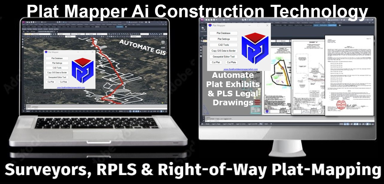
Plat Mapper AI is a digital-twin centerline route-based plat-mapping 2D AI engine. Plat Mapper is an enterprise software that automates Sketch Plats, Plat Exhibits, RPLS Legal Sheets, GIS data management, and includes the Parcel Legal Writer.
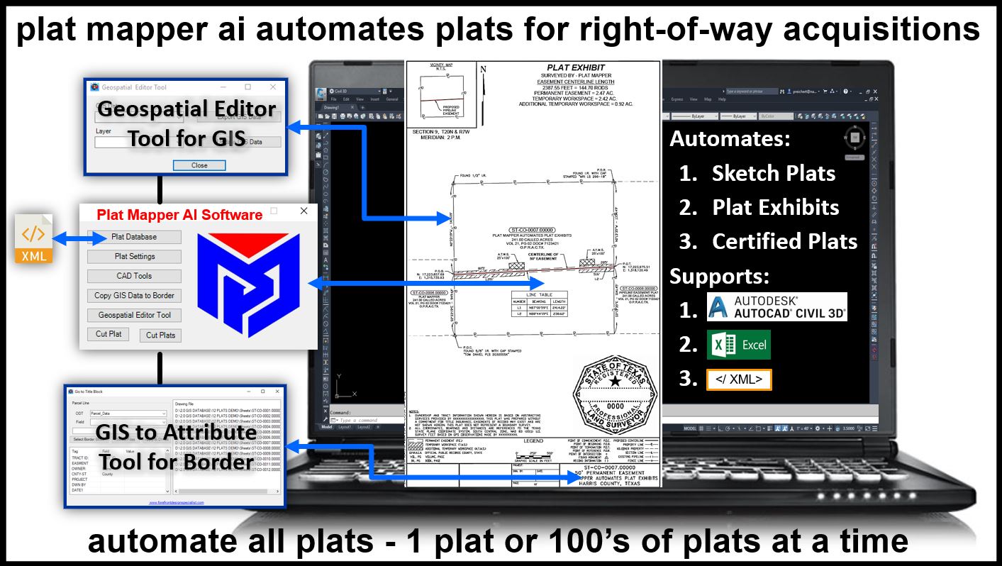
Plat Mapper is a purpose-built 2D survey and right-of-way plat drawing technology. Whether you need a single plat or hundreds, Plat Mapper delivers with precision—line tables generated, border attributes set, calculations complete, GIS data embedded, legal sheets finished, and parcel line lists created.
Faster plats mean more business.
PLAT MAPPER Ai SOFTWAREPlat Mapper AI is advanced 2D centerline route-based survey right-of-way plat exhibit technology. Create sketch plats, one plat, or hundreds of plats exhibits in minutes—fully equipped with line calculations, line tables, border attributes, GIS integration, completed legal sheets, and parcel line lists.
|
|
|
SURVEY RIGHT-OF-WAY MANAGEMENTPlat Mapper design cuts one plat at a time or hundreds of plats at a time. Manages survey parcel process and survey plat drawing process. Automate plats with scaled viewport, set calculations, centerline labels, parcel line table, legal description, GIS parcel labels, line table, workspace line table, and has a batch scripter for global edits.
|
PRODUCT FEATURESPlat Mapper Ai comes with four approved RPLS plat border templates, detail sheet, legal sheet, annotative parcel labels, color table, excel support, directory structure support, map projection technology and a CAD Toolbox with extra support features. Includes the Geospatial Editor for GIS data management and the best communications.
|
|